
Travelers visiting Korea for the first time—or even those stepping into the dense urban maze of Seoul—often find themselves bewildered. The global gold standard, Google Maps, frequently fails to provide walking directions or leads people astray with outdated data.
This happens because Korean national security laws restrict the export of high-precision mapping data to foreign companies. Without using locally optimized apps, even the most seasoned traveler can become a “Gil-chi” (a Korean term for someone with a poor sense of direction). Here is your essential guide to navigating Korea like a local.
Why Doesn’t Google Maps Work Properly in Korea?
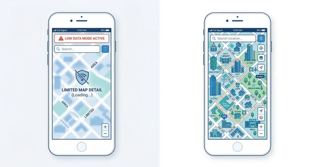
The first habit you must break when traveling to Korea is relying on Google Maps. The reason this global giant struggles here is the Korean government’s 2007 decision to prohibit the export of high-precision map data.
As an armistice state where the war with North Korea has not officially ended, the government views the export of detailed mapping data as a significant national security threat. As of 2026, the situation is shifting toward providing high-precision maps to Google through conditional approval, so accuracy is expected to improve in the future. However, for now, it is highly recommended to use Naver Map or KakaoMap.
Naver Map
- Web: map.naver.com
- Google Play: Download here
- App Store: Download here
KakaoMap
- Web: map.kakao.com
- Google Play: Download here
- App Store: Download here
Understanding the Address Systems: Road Name vs. Land-lot
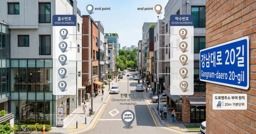
In 2014, Korea officially transitioned from the old Land-lot address system to the Road Name address system. However, since both are still used interchangeably, it can be quite confusing.
- Road Name Address Logic: These consist of a ‘Road Name + Building Number’ (e.g., 78, Namdaemun-ro). If the building number is odd, it is on the left side of the street; if it is even, it is on the right.
- Navigation Tip: Look for the blue road name signs attached to the sides of buildings. By comparing your current building number with your destination’s number, you can quickly determine if you are walking in the right direction.
Strategies for Navigating Complex Subway Stations
Major hubs like Seoul Station or Gangnam Station are massive underground complexes connected to shopping malls, making it easy to lose your way. In these cases, following the visual guidelines on the floors and ceilings is the most accurate method.
- Follow the Line Colors: Look for the specific color of the line you are transferring to (e.g., Green for Line 2, Gold for Line 9) and simply follow the colored stripes on the floor.
- Exit Number Signage: Before passing through the turnstiles, check the yellow signs hanging from the ceiling. They list street names and major landmarks for each exit. Always cross-reference the exit number on your map app before heading up.
❓ Frequently Asked Questions (FAQ)
Q1. Can I catch a taxi without the Kakao T app?

Yes, you can hail a taxi on the street. Look for the red “빈차” (Empty) sign on the dashboard. Note that if the sign is green and blue “예약” (Reserved), the taxi has already been called and cannot pick up passengers. While you can hail a cab, it’s best to show the driver the destination address in Korean. For the safest and most accurate experience, it is better to install the Kakao T app and input your destination in advance.
Q2. How does the bus numbering system work?
In Seoul, Blue buses (Trunk) cover long distances, while Green buses (Branch) connect subway stations to residential areas. Yellow buses are circular routes, and Red buses (Gwang-yeok) are express buses to suburban areas. You can check the real-time location of any bus (updated every 5–10 seconds) via Naver Map.
Q3. What if I board the subway in the wrong direction?
In many Korean subway stations, you can cross to the opposite platform without exiting the ticket gates. If you do have to pass through the gates to reach the other side, Korea has a “Same-station Re-entry Policy.” If you tag your card and enter the opposite gate at the same station within 5 minutes, you will not be charged an extra fare.